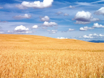
I traveled with Melodie, Rick and Emily Gustavsen from Walla Walla Washington to Los Alamos New Mexico. It was a long drive (We spent 22 hours in the car over two days time). Fortunately, we listened to some audiobooks to pass the time and that was fun.
We drove through six states - Washington, Oregon, Idaho, Utah, Colorado and New Mexico!
View Larger Map
I saw the beautiful Wallowa Mountains in Oregon. Idaho has a lot of farm country. I saw some dairy farms and Melodie told me about the corn fields in the summer time. In November, the fields were all plowed and flat and boring!
We drove on into Utah past the Great Salt Lake which is a huge lake which gets its name from the fact that it is very salty. To learn more about the lake click here.
View Larger Map
Where the lake has dried up there are vast flat areas called salt flats. The Bonneville Salt Flats are famous as a place where many land speed records are set.
There was a movie a few years ago - The World's Fastest Indian about an old man from New Zealand who came to Bonneville to see how fast he could go on his motorcycle which was called an Indian.
I learned about one of these fast cars - the Blue Flame. that has been on display in a museum in Germany. I'd like to try to go see it when I get home.
Salt Lake City is at the foot of some beautiful mountains. It was the site of the 2002 Winter Olympic Games.
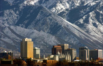
I picked up a post card to help me remember the big city with the mountains on one side and the big lake on the other. In southern Utah the land really changed. There are interesting rock shapes and canyons everywhere. We saw Arches National Park. I have a postcard of rock arches and towers!
We drove on to Colorado - which has many beautiful trees and mountains. I took a ride on a train in Durango up through the mountains. That was fun and very pretty with lots of snow everywhere.
In New Mexico I have seen four different cities.
View Larger Map
First I stopped at Taos Pueblo. This Native American town was built around 1000 A.D. and people have lived in it ever since! The Pueblo people make pottery and jewelry to sell.
Next we visited Santa Fe which has the oldest church and house in the United States (the oldest built by Europeans!). Spanish settlers traveled up from Mexico in 1610 to start this interesting city. There is a lot to see in Sante Fe. Click here for more information on Sante Fe.
We also visited Bandelier National Monument where there are ruins of cliff dwellings by ancient pueblo people. I have post cards from these stops.
On a more modern note, Rick Gustavsen works at Los Alamos National Laboratory. This is a large scientific research center in the small town of Los Alamos. Almost everyone who lives in this town has a family member who is a scientist (physicist, chemist, engineer, mathematician).
I'm a little nervous staying with the Gustavsen's however because of the wild cats that roam their home! I'm packing up today to head back to Fresno! I wonder what I'll see next!
Monday, December 1, 2008
Tuesday, November 25, 2008
Thanksgiving Holiday
I spent American Thanksgiving with the Gustavsen Family in Walla Walla
Washington. Here are some pictures of the fun we had.
We played games and put together puzzles. Eric and Diane Gustavsen
had already had a visitor from Germany last year. She was an exchange
student who brought them a German flag. I was happy to see my home
flag!
American's celebrate Thanksgiving by remembering the good things from
the last year and having a feast. You can see me with the turkey and
Thanksgiving pies and rolls. I ate so much! Then I watched American
football on TV.
Sunday, November 23, 2008
Seattle to Walla Walla
On Tuesday, November 23 we drove over the Cascade mountains into the farm country of eastern Washington State.
View Larger Map
Eastern Washington is much drier than western Washington because the mountains cause the clouds which travel off the Pacific Ocean to drop most of their moisture in the form of rain before they get to the east side of the mountains.
Washington farms grow many things but they are most famous for Apples, Wheat and Grapes for making wine.
To provide water for agriculture and power for northwest U.S. cities huge dams have been built along the Columbia River. These dams provide water for huge circle irrigation systems that go around and around spreading water over the crops. In this google map you can see a dam near where we drove and the green circles of the fields around it.
View Larger Map
Here is what the giant irrigation systems look like.
Washington is also famous for Salmon. These fish need to make their way up the Columbia river each year to spawn. Fish ladders have been built so that the Salmon can get around and over the big dams.
View Larger Map
Eastern Washington is much drier than western Washington because the mountains cause the clouds which travel off the Pacific Ocean to drop most of their moisture in the form of rain before they get to the east side of the mountains.
Washington farms grow many things but they are most famous for Apples, Wheat and Grapes for making wine.
To provide water for agriculture and power for northwest U.S. cities huge dams have been built along the Columbia River. These dams provide water for huge circle irrigation systems that go around and around spreading water over the crops. In this google map you can see a dam near where we drove and the green circles of the fields around it.
View Larger Map
Here is what the giant irrigation systems look like.
Washington is also famous for Salmon. These fish need to make their way up the Columbia river each year to spawn. Fish ladders have been built so that the Salmon can get around and over the big dams.
Tuesday, November 18, 2008
Seattle Space Needle
I went with my friend Laural to the Seattle Space Needle. Here's a picture with Laural and her friends, John, Alex and Jacob. We took a picture at the tourist photo place in front of a picture of the space needle - kinda hokey since the real space needle was right above us. Someone said they have this because it rains so often that tourists want to stay indoors for their pictures.
At the top is an observation deck where you can look down on the city of Seattle. Pretty cool. And they have binoculars so you can into the distance or even look into people's windows close by.
Its pretty high and I got a little shaky when I looked down.
I was glad to get my feet back on the ground.
Friday, October 31, 2008
Working at Starbucks
I like working at Starbucks. I found out that Starbucks Headquarters is in Seattle. So working at a store in the area was really fun.
Working on Halloween was fun. Customers would come in dressed up in costumes, as well as my fellow baristas. Here I am with Laural who was dressed as an escaped mental patient costume. At least she said it was a costume.
I think Jonathan is mad at me because Jasmine likes me better than him. I think that's only because of the accent. American Girls like foreign accents.
I got to helping out Jennifer at the cash register. My job was to keep track of the paper cups. It's hard for me to write cups for the drinks because the pens are as big as me. I think my favorite part of working there was the fun atmosphere and talking with customers.
Becasue im still in training, sometimes I get in trouble and I blush. Hey it takes a little bit of time to get the hang of being a barista. I've got it down now. Will that be a Triple Venti 2/3 decaf Sugar-free Carmel Nonfat with whip Mocha?
Tuesday, October 28, 2008
Trip to Boston
October 23-24 I went with my friend Rick to Boston. Rick had a business meeting and it gave us a chance to do some sightseeing in this city which was such an important part of the birth of the United States.
It was a pretty long flight - more than 5 hours. Looking out the window I got to see a lot of the United States. There's a lot more space between cities and towns in the U.S. than I'm used to seeing when I fly around in Europe. Looking at a map I was surprised to see that we'd crossed the whole country.
View Larger Map
Before the United States was a country it was inhabited by Native Americans who are believed to have come over from Asia through Russia to Alaska at the time of the Ice Age. Before 1700 the huge continent of North America was very sparsely settled. Explorers from Europe came to North America and were followed in the 1700's by settlers from Great Britain, Spain and other countries. The settlers that founded the Massachusetts Bay Colony (the Boston area) were from Great Britain.
In 1773 Boston was a trading town with its port on the Atlantic Ocean. The settlers began to rebel against "taxation without representation" and protested with a famous episode in which they dumped tea off of the British merchant ships into the Boston Harbor. It became known as the Boston Tea Party. The area around Boston was where many battles of the revolutionary war took place in which the United States broke away from Great Britain to become an independent country.
Boston is one of the oldest cities in the United States, though not nearly as old as many cities in Europe.
There are a lot of historical places to see in Boston. We took a tour and I collected a bunch of stuff to put in my scrapbook when I get home. My favorite places were the Quincy Market and the Boston Common.
Quincy Market is a really energetic place with indoor and outdoor shops. Lots of people of all ages. Lots of music and good food.
Here I am at Faneuil Hall and the Quincy Market.
Here's a link to more information about:
Faneuil Hall
Quincy Market
The Boston Common is a large park in the middle of the city. Nicki and Joni wrote in a letter they sent with me about how much I like to lay down in the sun in a park - well, this was a great park for me. Here are a couple pictures and a link to some more information about the Boston Common.
Here's a link to some more information about the Boston Common.
Also check out the album of pictures from my Boston Trip.
It was a pretty long flight - more than 5 hours. Looking out the window I got to see a lot of the United States. There's a lot more space between cities and towns in the U.S. than I'm used to seeing when I fly around in Europe. Looking at a map I was surprised to see that we'd crossed the whole country.
View Larger Map
Before the United States was a country it was inhabited by Native Americans who are believed to have come over from Asia through Russia to Alaska at the time of the Ice Age. Before 1700 the huge continent of North America was very sparsely settled. Explorers from Europe came to North America and were followed in the 1700's by settlers from Great Britain, Spain and other countries. The settlers that founded the Massachusetts Bay Colony (the Boston area) were from Great Britain.
In 1773 Boston was a trading town with its port on the Atlantic Ocean. The settlers began to rebel against "taxation without representation" and protested with a famous episode in which they dumped tea off of the British merchant ships into the Boston Harbor. It became known as the Boston Tea Party. The area around Boston was where many battles of the revolutionary war took place in which the United States broke away from Great Britain to become an independent country.
Boston is one of the oldest cities in the United States, though not nearly as old as many cities in Europe.
There are a lot of historical places to see in Boston. We took a tour and I collected a bunch of stuff to put in my scrapbook when I get home. My favorite places were the Quincy Market and the Boston Common.
Quincy Market is a really energetic place with indoor and outdoor shops. Lots of people of all ages. Lots of music and good food.
Here I am at Faneuil Hall and the Quincy Market.
From Boston |
From Boston |
Here's a link to more information about:
Faneuil Hall
Quincy Market
The Boston Common is a large park in the middle of the city. Nicki and Joni wrote in a letter they sent with me about how much I like to lay down in the sun in a park - well, this was a great park for me. Here are a couple pictures and a link to some more information about the Boston Common.
From Boston |
From Boston |
From Boston |
Here's a link to some more information about the Boston Common.
Also check out the album of pictures from my Boston Trip.
Wednesday, October 22, 2008
A very long drive - Fresno to Seattle
On Sunday, October 20 I rode with Rick as he drove almost 1000 miles in two days from Fresno, California to Sammamish, Washington (not far from Seattle). On the trip we went from the state of California north through the state of Oregon and finally into the state of Washington. Each of these states has its own state government and different laws about things like speed limits on the highway. Each state has its own police force. But all states are part of the United States of America and also share many laws and have the same president.
For the first few hours we drove along Highway 99 through the heart of California's agriculture region. This farming area produces huge quantities of all kinds of food.
In Sacramento, the capital city of California, we got onto a major highway called Interstate 5 (most people here call it I-5). It runs all the way from the border with Mexico to the south of the United State into Canada to the north. From Sacramento on to Seattle we stayed on I-5 the whole way.
Most of the way we could see a mountain range on our right to the east of us. In California the mountains are called the Sierra Nevada Mountains. In the states of Oregon and Washington the mountain range is called the Cascades. Many of the mountains are volcanoes. Some, like Mt. St Helens in Washington state are pretty active.
We stayed the night in Redding and drove on the next day into Oregon and Washington. Here is a map that shows our route.
View Larger Map
There is an photo album in my Google Photos section (Picasa) which includes pictures of some of the places of interest along the way.
There were so many amazing things to see. Here's a map with some of the places of interest marked.
You can click back and forth from the Map button to the "Sat" button. Sat is short for Satellite - which are photographs from the air. You can zoom in and out to see the mountains and even the buildings I've marked.
When you click on something I've marked a bubble will open to show you something I've written about it. Sometimes there are links which you can click to get more information and see other cool stuff - like exploding volcanoes and sinking or collapsing bridges (you gotta see these). To keep the map open, you can click the right mouse button and open the link in a new window or tab.
View Larger Map
Subscribe to:
Posts (Atom)